VISIT OUR FACEBOOK PAGE!
BIBLICAL MAPS
Biblical maps bring the Bible to life. When one has an understanding of the geography involved in Biblical events, it is like watching an HD television as opposed to listening to AM radio. Biblical maps bring the characters & events of the Old & New Testaments to life.
For example, in the Abraham narrative we are told Abraham traveled to Bethel and encamped on a mountain "to the east of Bethel". This seems like a rather mundane & innocuous detail. When one views this area on a simple Google Earth map there is a mountain precisely there by ancient Bethel just as the Bible describes.

This level of detail lends credibility to the Scriptures as being eye witness events. If the writer gives that much detail to the geography and land, and the places and people groups mentioned are indeed historical, then why would not the characters and events of the Bible in fact be true accounts?
Gallery of Various Biblical Maps
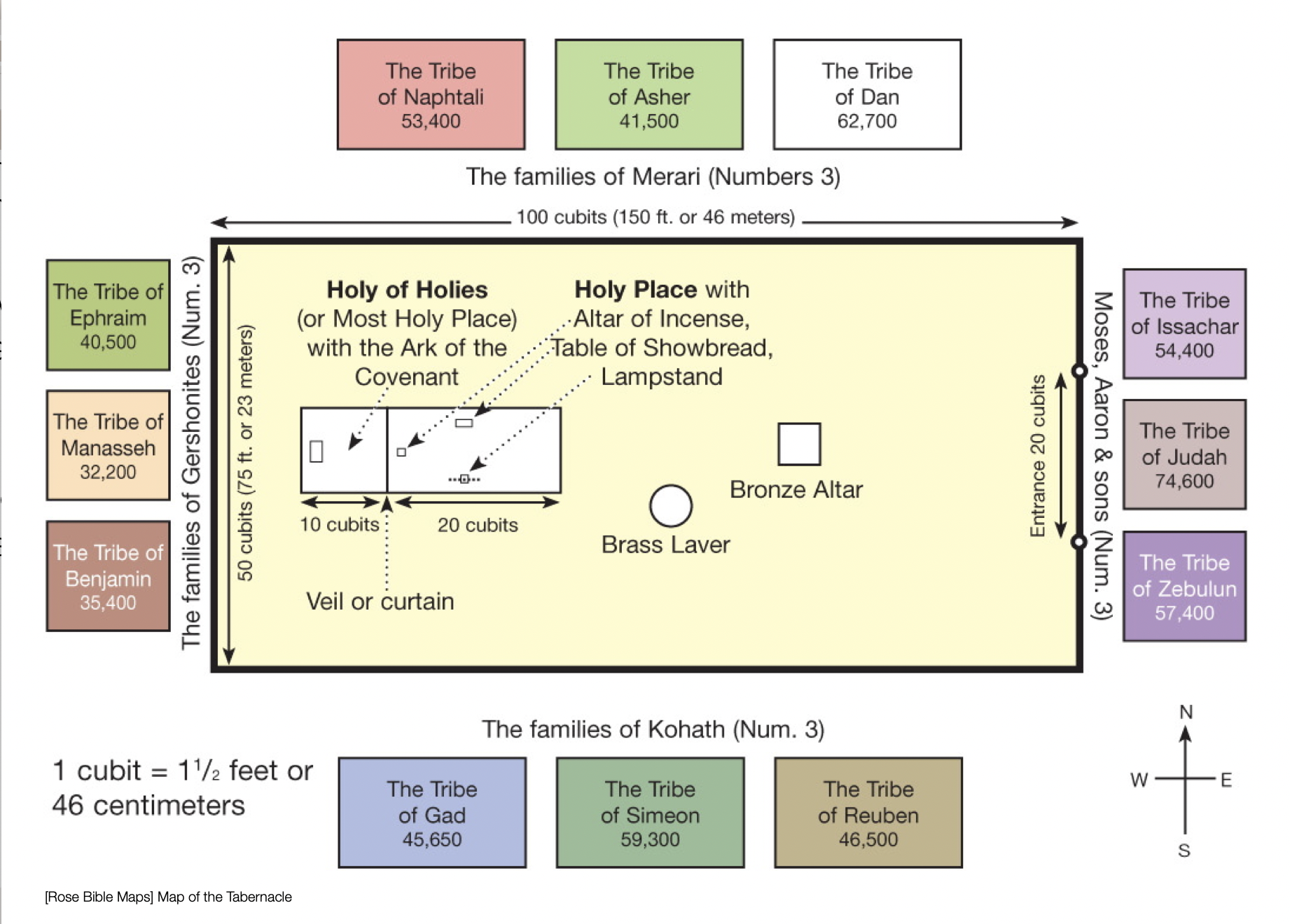
Biblical Maps of Old Testament Pre-historyThe Sons of NoahThe Land of EdenAncient SumeriaAncient Sumeria was the first recorded kingdom ca. 3000 BC. Sumer is intimately connected with the Biblical narrative in a number of ways, perhaps most notably as the home of Abraham. Abraham traveled from Ur in southern Mesopotamia to Canaan. The Land Between Two Rivers is alternative designation for the Ancient Sumerian Empire. The Bible says after the flood the people migrated & settled on the Plains of Shinar. Perhaps these early settlers were the Sumerians, or, progenitors to the Sumerians. Very little is actually known about this super-advanced civilization. The 12 Tribes of IsraelEach of the 12 sons of Jacob were progenitors of the twelve tribes of Israel. After the Conquest each tribe was allotted territory with specific boundaries. This biblical map depicts the boundaries of the twelve tribes. The Tabernacle of Moses & Jewish TempleThe Tent of Meeting, or Tabernacle, was the original form of Israel's temple. It was used as the meeting place for Yahweh during the 40 years in the desert. It was the forerunner of Solomon's First Temple and Herod's Second Temple during the time of Jesus. Herod's Temple during Passover thronged with pilgrims from all over Israel. Worshippers flooded Jerusalem and the Temple precincts as the city swelled in population to upwards of 250,000. The City of David remained buried under the debris of a millennia prior to archaeology unearthing its ruins. The painting below depicts the view of the Temple complex looking westward from the mansion of the High Priest. The Temple faced east, towards the Mount of Olives in the background. Today the Dome of the Rock dominates this view. View & Compare other Websites with Biblical maps. The Monarchies of IsraelAncient Empires of the Old Testament World
|


 were expanded.")


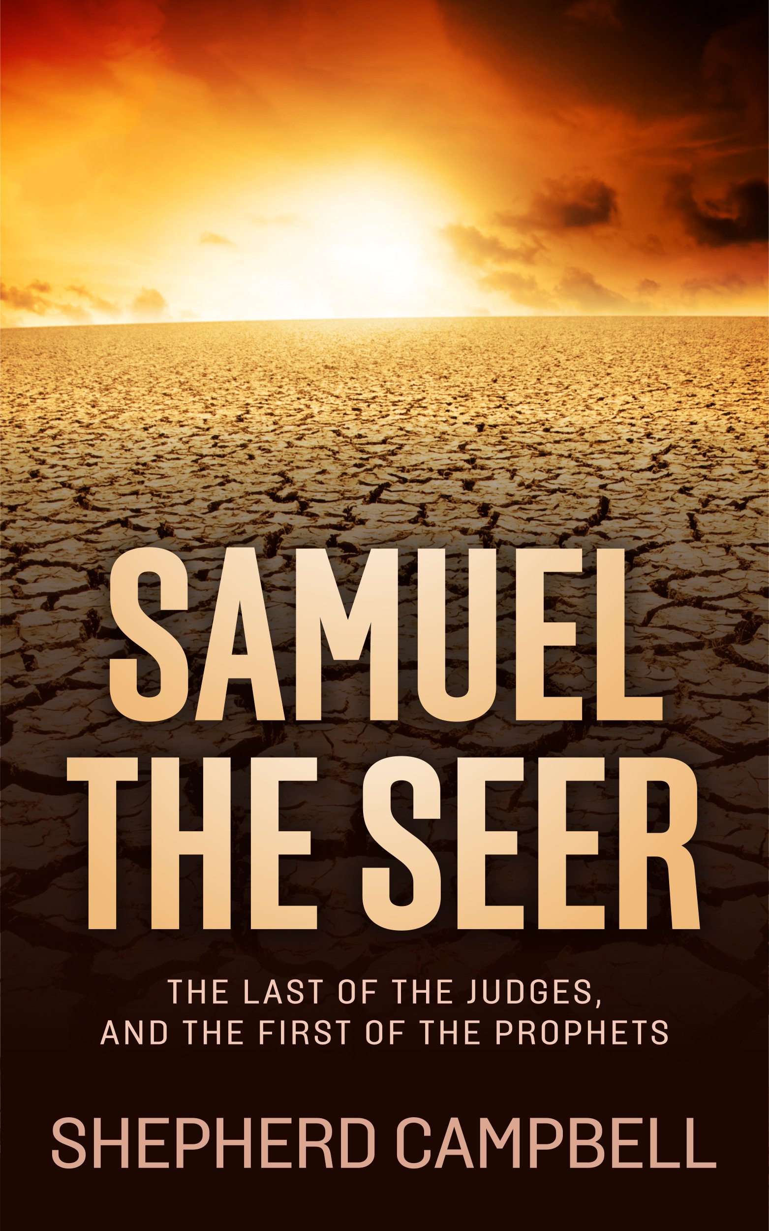
SAMUEL the SEER
Now Available in Print & eBook on Amazon!!
POPULAR TOPICS
Learn more about these popular topics below. The Bible is full of fascinating stories, characters and mysteries!
BIBLE MAPS
Explore the land of the Old Testament! View these maps of the Bible.

%20were%20expanded.)